Travel Guide · Travel Guides · Updated July 2026
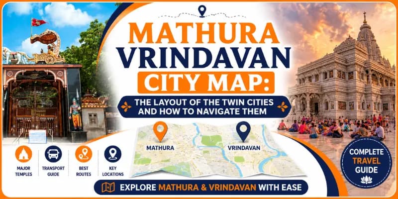
Mathura Vrindavan City Map: The Layout of the Twin Cities and How to Navigate Them
By Gurudutt, Experience My India·31 July 2026
Quick Answer
Quick Enquiry
Key facts at a glance
The two cities | Mathura and Vrindavan, about 13 km apart |
On the river | Both on the Yamuna; Mathura on the west bank |
Mathura's heart | The Krishna Janmabhoomi, Dwarkadhish and the old-city ghats |
Vrindavan's heart | The lanes around Banke Bihari, with ISKCON and Prem Mandir outside |
Connected by | The Mathura-Vrindavan road and the NH-2 highway |
Approximate location | Around 27.5 N, 77.7 E, in western Uttar Pradesh |
Mathura Vrindavan city map: an overview
Understanding the map of Mathura and Vrindavan makes visiting the twin cities far easier, because although they are close, only about 13 km apart, each has its own character and layout and the old quarters are a maze of narrow lanes that no single glance at a map fully captures. This guide is a map in words: it lays out how the two cities sit on the Yamuna, their main areas and landmarks, where the great temples are, the distances between them and how to find your way around.
In brief: Mathura, the larger, older city, sits on the west bank of the Yamuna, its heart the Krishna Janmabhoomi, the Dwarkadhish temple and the old-city ghats. Vrindavan lies about 13 km to its north, a dense weave of temple lanes around Banke Bihari, with the big modern temples like ISKCON and Prem Mandir on its outskirts. The two are joined by the Mathura-Vrindavan road and the NH-2 highway. For the distance and journey between them, see our mathura to vrindavan distance guide.
From the ground (Gurudutt): The single most useful navigation truth for the twin cities: the old quarters of both Mathura and Vrindavan are mazes of narrow lanes where vehicles cannot go and even map apps struggle, so navigate by the big landmarks, the Janmabhoomi, Dwarkadhish and Vishram Ghat in Mathura, Banke Bihari, ISKCON and Prem Mandir in Vrindavan and cover the last stretch to each on foot or by cycle-rickshaw, asking locals as you go. A live map gets you to the edge of the old town; landmarks and locals take you the rest of the way. See our Mathura Vrindavan tour or message WhatsApp +91 7302265809.
The twin cities at a glance
Here are the essential map facts for Mathura and Vrindavan in one place.
Detail | Mathura | Vrindavan |
Role | The larger, older city, Krishna's birthplace | The temple town of Krishna's childhood |
Position | On the west bank of the Yamuna | About 13 km north of Mathura, on the Yamuna |
Heart of the city | Krishna Janmabhoomi, Dwarkadhish, the ghats | The old lanes around Banke Bihari |
Big temples outside the core | Gita Mandir, the museum area | ISKCON, Prem Mandir, Chandrodaya |
Approx coordinates | About 27.5 N, 77.7 E | About 27.6 N, 77.7 E |
Main entry road | NH-2 and the Mathura bypass | The Chhatikara road from NH-2 |
Getting around | Autos, e-rickshaws; old city on foot | E-rickshaws, cycle-rickshaws; lanes on foot |
In one line: Mathura sits on the west bank of the Yamuna around its Janmabhoomi and ghats; Vrindavan lies about 13 km north, a maze of temple lanes around Banke Bihari with ISKCON and Prem Mandir on its edges; the NH-2 and the Mathura-Vrindavan road join them.
The geography: how the twin cities are laid out
Mathura and Vrindavan lie in the western part of Uttar Pradesh, on the great bend of the Yamuna, at roughly 27.5 degrees north and 77.7 degrees east, in the heart of the Braj region. The Yamuna flows through the landscape and defines both cities: Mathura spreads along its west bank and Vrindavan sits on the river a little to the north, so the river is the great constant that links the two.
Mathura is the larger and more spread-out city, an ancient working city as well as a sacred one, with its old quarter by the river and newer areas, the railway station, the bypass and the highway, spreading westward and southward away from the Yamuna. Vrindavan, about 13 km to the north, is smaller and denser, a compact old town of temple lanes near the river, now ringed by newer development, ashrams and the big modern temples along its approach roads. Between and around them lie the wider Braj towns. Holding this simple picture, Mathura on the river to the south, Vrindavan on the river to the north, the two joined by road, is the key to the whole map.
Mathura city map in words
Mathura's sacred heart lies by the Yamuna and just inland from it and most of its great sites cluster in and around the old city.
The Krishna Janmabhoomi complex, the birthplace of Krishna, near the Bhuteshwar area to the west of the old city, is the city's most important site and a key orientation landmark.
The old city and its ghats along the Yamuna, with Vishram Ghat, chief of the twenty-five ghats, at the heart of the riverfront, reached through the Holi Gate and Chowk Bazaar area.
The Dwarkadhish temple, in the old city near the ghats, the grand temple that anchors Mathura's riverside quarter.
The Government Museum, for the Mathura school of art, in the newer part of the city and the Gita Mandir on the Vrindavan road; Krishna Nagar and the highway lie on the city's edge.
So a simple mental map of Mathura runs from the Janmabhoomi in the west, through the old city and its bazaars, down to the Yamuna and Vishram Ghat with the Dwarkadhish temple nearby, with the railway station, museum, highway and newer areas spreading out around this old core. Our places to visit in mathura guide covers each of these sites and our krishna janmabhoomi temple guide the birthplace itself.
Vrindavan city map in words
Vrindavan's layout is best understood as a dense old core of temple lanes near the river, ringed by newer areas and the big modern temples along its approach roads.
The old town, a maze of narrow lanes near the Yamuna, holds the beloved Banke Bihari temple at its heart, along with the Radha Raman, Radha Damodar and other ancient temples and Nidhivan; this is the devotional core, best explored on foot.
The riverfront, with Keshi Ghat, the grandest ghat and the Madan Mohan temple on its hill nearby, along the Yamuna on the town's edge.
The approach roads and outskirts, where the big modern temples stand: ISKCON's Krishna-Balaram Mandir in the Raman Reti area, and, along the Chhatikara road from the highway, Prem Mandir and the towering Chandrodaya Mandir.
The Parikrama Marg, the circumambulation path, rings the old town and Attalla Chungi and the bus stand mark its gateways.
So a simple mental map of Vrindavan runs from the big temples on the Chhatikara road and outskirts, in toward the dense old-town lanes around Banke Bihari near the river, with Keshi Ghat and the riverfront on one side and the Parikrama Marg ringing it all. Because the old lanes are so narrow and winding, this landmark-based picture matters more than street names. Our banke bihari temple guide covers the heart of the old town.
The map between them: how the two connect
Mathura and Vrindavan, about 13 km apart, are joined by two main routes. The direct Mathura-Vrindavan road runs between the two old cities, the traditional link, passing through the built-up stretch that increasingly joins them. The NH-2, the national highway and the wider Yamuna Expressway corridor, runs past both, with the Chhatikara road connecting the highway to Vrindavan and the big temples on its approach.
For the visitor, this means the two cities are an easy 30 to 45 minute drive apart and the space between them, once open country, is increasingly filled with ashrams, temples and development, so that Mathura and Vrindavan are growing toward each other as one urban area. Frequent autos, taxis, buses and a heritage rail line ply the route. Our mathura to vrindavan distance guide covers the journey between them in detail and our how to reach vrindavan guide the routes into the twin cities from outside.
Distances between the key landmarks
Here are the approximate distances between the main landmarks of the twin cities, to help you plan your movements.
From | To | Approx distance |
Mathura Junction railway station | Krishna Janmabhoomi | About 4 km |
Krishna Janmabhoomi | Dwarkadhish temple / Vishram Ghat | About 3 to 4 km |
Mathura (Janmabhoomi) | Vrindavan (Banke Bihari) | About 13 to 15 km |
Vrindavan bus stand | Banke Bihari temple | About 2 km, part on foot |
ISKCON Vrindavan | Banke Bihari temple | About 3 to 4 km |
Prem Mandir | Banke Bihari temple | About 2 to 3 km |
Chhatikara (NH-2) | Vrindavan (Prem Mandir) | About 5 km |
Note: These are approximate road distances; within the old quarters of both cities, the final stretch to many temples is through narrow lanes covered on foot or by cycle-rickshaw, so allow extra time beyond the driving distance.
How to navigate the twin cities
Navigating Mathura and Vrindavan is mostly straightforward, with one big caveat: the old quarters defeat both vehicles and, often, map apps.
Use a live map app, such as Google Maps, to reach the edge of each old town and to find the big temples on the outskirts, which it locates well.
For the old-town temples, navigate by the big landmarks, Banke Bihari, the Janmabhoomi, Dwarkadhish and cover the final lanes on foot or by cycle-rickshaw, asking locals, who will readily point the way.
Use e-rickshaws and autos for getting around and between areas and cycle-rickshaws for the edges of the old lanes; much of the old core is vehicle-free.
Between the two cities, take a taxi, auto, bus or the heritage train over the 13 km.
In short, a map gets you to the neighbourhood; landmarks and locals get you to the temple door. Do not rely on driving right up to the old-town temples and build in time for walking the lanes. Our how to commute in vrindavan guide covers getting around in detail and our mathura vrindavan local sightseeing guide how to sequence the sights.
Where the main temples are
To orient the great temples on your mental map of the twin cities:
In Mathura: the Krishna Janmabhoomi to the west of the old city; the Dwarkadhish temple and Vishram Ghat together in the old riverside quarter; the Gita Mandir on the Vrindavan road.
In Vrindavan's old town: Banke Bihari at the heart of the lanes, with Radha Raman, Radha Damodar and Nidhivan close by and Keshi Ghat on the riverfront.
On Vrindavan's outskirts: ISKCON in Raman Reti; Prem Mandir and the Chandrodaya Mandir along the Chhatikara road; the Rangaji temple toward the old town.
In the wider Braj, reached by road: Govardhan to the west, Barsana and Nandgaon further west, Gokul and Mahavan across the Yamuna south-east of Mathura.
Holding this picture, Mathura's sites by its river, Vrindavan's split between the old-town lanes and the outskirts temples and the wider Braj beyond, turns the confusing sprawl of the twin cities into a clear and navigable map in your mind.
Using a map: practical tips
A few practical tips make using a map of the twin cities far easier. Download an offline map of the area on your phone before you go, in case of patchy signal in the lanes and drop pins on your accommodation and the temples you plan to visit. Note that many old-town temples are best searched by name in a map app, which will take you to the nearest lane entrance, from where you walk. Keep your accommodation's location and a local landmark handy to find your way back.
One honest note about this page: being a written guide, it maps the twin cities in words and distances rather than as a live, zoomable map, which no static page can fully replace. For actual turn-by-turn navigation, use a live map app on the ground, and, if you are the site owner reading this, an embedded interactive map on the page itself is the ideal companion to this written guide. Better still, let us handle the navigation for you: we arrange complete Mathura and Vrindavan visits, with the transport, the routing between the two cities and their temples and a local guide who knows every lane, so you never need to find your own way. A shared day tour of the twin cities starts from around ₹1,499 per person and our two-day mathura vrindavan tour and one-day vrindavan tour package cover the cities in full. Message me on WhatsApp at +91-7302265809 to plan your visit.
Related guides
Meet Gurudutt — Your Mathura Vrindavan Guide
Not just a tour operator — Gurudutt was born and raised in Braj Bhoomi. He has spent over a decade personally guiding pilgrims through the sacred lanes of Mathura & Vrindavan.
Founder – Experience My India
Gurudutt
Founder · Experience My India